1 thought on “Drainage Delineation Using GIS: A Step-By-Step Guide”
Angel Omar Gallegos
As a drainage engineer with 6 years of design experience, I find DrainageReview.com to be a highly valuable and well conceived tool.
I personally have read the entire site and it’s good that too much information has been summarized in a way that I can remember key aspects of a design/review and feel a little less overwhelm when starting a new task. It’s good to know what I can come back anytime a re-check what it’s needed.
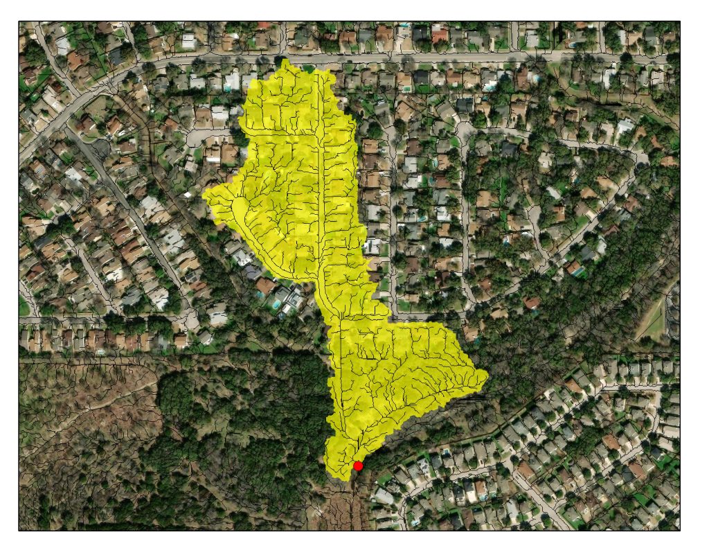
Anytime I’m doing a hydrologic analysis using GIS, I use the tools described in the “Drainage Delineation Using GIS: A Step-By-Step Guide” which I have memorized already. I highly recommend these tool, specially ‘Flow Accumulation’. Not matter how big or small a watershed is, It’s way easier to follow accumulation than contour lines or a terrain projection for drainage area delineation.
This website is a remarkably effective tool for both design and review tasks in drainage engineering. It strikes a strong balance between simplicity and functionality.
I would absolutely recommend it to other drainage engineers, reviewers, and even junior staff who are building their skills in hydrology and hydraulics.
As a drainage engineer with 6 years of design experience, I find DrainageReview.com to be a highly valuable and well conceived tool.
I personally have read the entire site and it’s good that too much information has been summarized in a way that I can remember key aspects of a design/review and feel a little less overwhelm when starting a new task. It’s good to know what I can come back anytime a re-check what it’s needed.
Anytime I’m doing a hydrologic analysis using GIS, I use the tools described in the “Drainage Delineation Using GIS: A Step-By-Step Guide” which I have memorized already. I highly recommend these tool, specially ‘Flow Accumulation’. Not matter how big or small a watershed is, It’s way easier to follow accumulation than contour lines or a terrain projection for drainage area delineation.
This website is a remarkably effective tool for both design and review tasks in drainage engineering. It strikes a strong balance between simplicity and functionality.
I would absolutely recommend it to other drainage engineers, reviewers, and even junior staff who are building their skills in hydrology and hydraulics.